

Sonus Maris
Sonus Maris is a collaboration between artist Dr Nigel Helyer and engineers and scientists at the UNSW Water Research Laboratory (WRL).
When:
6 February - 7 May 2023
Where:
Level 5 Main Library
Artist:
Dr Nigel Helyer
Partner:
Water Research Laboratory
Sonus Maris is an exhibition navigating the intersections between art and science emerging from an ongoing collaboration between artist Dr Nigel Helyer and water engineers and scientists at the UNSW Water Research Laboratory (WRL). Working in close partnership with WRL postdoctoral researcher Dr Tino Heimhuber, Helyer employs audio-visual media to reinterpret data charting the unique dynamics of intermittently closed and open lakes and lagoons (ICOLLs). ICOLLs are the most prominent type of estuaries found on the NSW coastline and are unique in that they alternate between open and closed oceanic entrance conditions, driven by the dynamic interplay between oceanic and land-based forces. Through data archaeology and a novel algorithm, Heimhuber extracts valuable information from a three-decade archive of public satellite imagery, drawing attention to long-term morphological and eco-hydrological variations in these crucial sites. Helyer interprets this detail-rich source material to compose a musical score translating the changeability of ICOLLs as a multisensory experience. Helyer's experimental music invites audiences to rethink knowledge systems by seeing, feeling, and hearing the flows and patterns of coastal environments.
This exhibition is developed in collaboration with UNSW Water Research Laboratory and UNSW Engineering with funding support from the UNSW Global Water Institute.
Top image: Photograph of Smiths Lake by Dr Valentin Heimhuber, November 2022.
Accessibility: UNSW Library is wheelchair accessible. Audio-described guides, braille and large-text exhibition guides are available.
Exhibition text
See the exhibition catalogue for essays and the list of works featured. Download the Sonus Maris art labels and large print exhibition guide below.
Exhibition image gallery

Sonus Maris Installation - Exhibition entry

Sonus Maris Installation - Gallery 2

Sonus Maris Installation - looking into Gallery 3

Sonus Maris Opening Night - Guests in Gallery 2

Sonus Maris Opening Night - Guests in Exhibition entry

Sonus Maris Opening Night - Guests looking at a rare book

Sonus Maris Opening Night - Guests in Gallery 1

Sonus Maris Opening Night - Guests in Gallery 2 looking at the exhibition

Sonus Maris Opening Night - Dr Nigel Helyer, Professor Ian Turner, Dr Megan Fizell

Sonus Maris Installation - Jervis Bay Maritime Museum

Sonus Maris Installation - Jervis Bay Maritime Museum
Audio guide
Dr Nigel Helyer audio-describes the artworks featured in Sonus Maris. The approximate run time is 19 minutes.
-
Transcript of audio description at exhibition entry
Sonus Maris is an exhibition navigating the intersections between art and science emerging from an ongoing collaboration between artist Dr. Nigel Helyer and water engineers and scientists at the UNSW Water Research Laboratory (WRL). Working in close partnership with WRL postdoctoral researcher Dr. Tino Heimhuber, Helyer employs audio-visual media to reinterpret data charting the unique dynamics of intermittently closed and open lakes and lagoons (ICOLLs). ICOLLs are the most prominent type of estuaries found on the NSW coastline and are unique in that they alternate between open and closed oceanic entrance conditions, driven by the dynamic interplay between oceanic and land-based forces. Through data archaeology and a novel algorithm, Heimhuber extracts valuable information from a three-decade archive of public satellite imagery, drawing attention to long-term morphological and eco-hydrological variations in these crucial sites. Helyer interprets this detail-rich source material to compose a musical score translating the changeability of ICOLLs as a multisensory experience. Helyer’s experimental music invites audiences to rethink knowledge systems by seeing, feeling, and hearing the flows and patterns of coastal environments.
A display case containing a map, open book, and printed text is at the exhibition entry against a bluish-grey wall. On the left is a multicoloured Map of Indigenous Australia, representing the language groups of First Nations peoples. The map divides the continent into numerous segments, each represented by a different colour. The book The Dharawal and Dhurga Languages of the New South Wales South Coast, located in the top right, is open to pages displaying a list of printed words related to land and water. The bottom right features an Acknowledgement of Country, which reads:
We acknowledge that this project encompasses the unceded territories of the Biripi, Jerrawangala, Jerrinja, Murramarang, Tharawal, Wandi Wandian, and Worimi peoples, who are the Traditional Owners of the lands and waters. We pay our respects to the Elders, both past and present, and extend that respect to other Aboriginal and Torres Strait Islanders attending this exhibition located on the unceded lands of the Bedegal peoples.
The estuarine systems featured in Sonus Maris are ecologically, economically, and culturally important. While this exhibition examines ICOLL changes over the past three decades, this is Aboriginal Land inscribed with more than 65,000-years of rich history and heritage. We recognise the longstanding and ongoing interdependent relationship the Traditional Owners have with these lands and waters.
-
Transcript of audio description at exhibition gallery 1
Gallery space one includes an audio-visual work titled Sonus Maris by Dr Nigel Helyer, projected onto the back wall, and a display case on the right side of the room. Sonus Maris is an eleven-minute artwork that begins with footage of a satellite launch and incorporates aerial views of the coastline with green and brown patches of land on the left and the deep blue ocean dotted with white waves on the right. Scientific data is overlaid on the coastline imagery, including charts, a date counter, and dotted lines tracing the water flow pathways. A monophonic piano score plays throughout the film.
The wall text for the audio-visual artwork reads: Sonus Maris is the outcome of an artist residency undertaken by Dr. Nigel Helyer at UNSW Water Research Laboratory (WRL). The audio-video artwork features sonified data charting the changing coastlines of Durras Lake, Shoalhaven Heads, Smiths Lake, and Farquhar Inlet, four New South Wales estuaries known as intermittently closed and open lakes and lagoons (ICOLLs). Dr. Helyer collaborated with WRL postdoctoral researcher Dr. Tino Heimhuber, who developed the open-source InletTracker toolkit. InletTracker enables researchers to unpack nearly 35 years of satellite imagery tracking the coastal dynamics of all ICOLLs and tidal inlets worldwide. Sonus Maris pairs data visualisations from Dr. Heimhuber's InletTracker with a monophonic soundscore developed by Dr. Helyer that correlates the note's pitch with the flow of water; high and low notes correspond to open (high flow) and closed (low flow) entrance conditions. Sonus Maris demonstrates the capacity for sound to translate information into an immersive environment, presenting aural processes as a way to interpret scientific data.
The display case positioned against the right wall of gallery space one includes stacks of paper with handwritten musical scores bound with bulldog clips, an open book displaying a facsimile of a piano score, and a long bar chart with physical annotations. Text positioned in the bottom right of the display case reads:
The graphic charts and sketches reveal Dr. Nigel Helyer’s process of assigning pitch to numerical data taken directly from the InletTracker toolkit. The data points on the graph correlate to an analysis of pixels in the legacy Landsat images, which Helyer translates to a musical note within the twelve-tone chromatic scale in C major. The handwritten notes in the middle column illustrate his working method. He assigns a lower pitch to lower numeric values, ascending note-by-note to higher octaves with higher numeric values. Helyer’s original handwritten scores for the four ICOLL sites encompass the final transposition of satellite data to music composition. The converted notes form a non-repeating ‘melody’ to be performed by a musician who was a pianist in the Sonus Maris soundscore.
In comparison, 24 Preludes by 19th-century Polish composer Frédéric Chopin demonstrates how Helyer modifies the written score format. Chopin’s sheet music includes the essential components of Western musical notation, a system of symbols used to visually represent tonal music. This includes the five-line staff with treble and bass clef to specify the range of notes relative to middle C and designate which hand typically plays the music; vertical bar lines to separate sections and measures of time; and the notes themselves, constructed with noteheads and stems signifying the duration which the note is to be held. Helyer sonifies data by manipulating this musical notation system, enabling audiences to encounter the coastal flows and changes captured in InletTracker through sound.
-
Transcript of audio description at exhibition gallery 2
Gallery space two features a series of satellite photographs lining the three walls, three pictures for each of the four ICOLL sites in Sonus Maris and two display cases positioned in the centre of the room. Each ICOLL photo group includes a large satellite photograph of the coastline, and two smaller photographs placed one above the other. The small pictures depict a blurry image of the site with a thin, yellow-dotted line tracing the water flow. Hung above each photo group are the geographical coordinates of each location printed in a bold, black font. The wall text to the right of each grouping provides a brief overview of the site, and in sequential order, they read:
Durras Lake, located on the traditional lands and waters of the Jerrinja, Jerrawangala, and Murramarang peoples of the Yuin Nation, is 20 kilometres north of Batemans Bay / Yangary (Walbunja) on the South Coast of NSW. It is filled with near pristine water surrounded by tall gum trees in Murramarang National Park. The estuary has large areas of salt marsh, with the entrance periodically opened artificially during low tide when the water height exceeds a trigger level. Occasionally during high rainfall, the lake will self-open to the sea, with a subsequent dry spell causing it to re-close.
The Shoalhaven, located on the traditional lands and waters of the Jerrinja, Tharawal, and Wandi Wandian peoples, is a barrier river estuary and is one of the largest catchments on the South Coast. It has two oceanic openings: Berrys Canal, constructed in 1822, which is always open, and the northern entrance, which is intermittently open during floods or other extreme weather events. The Shoalhaven River, originating in the Southern Tablelands, is joined by 34 tributary streams causing flowing freshwater to meet saltwater at the river’s entrance to the sea.
Smiths Lake, located on the traditional lands and waters of the Worimi peoples, is a saline lagoon on the Mid North Coast of NSW. A large coastal dune separates the lake from the Tasman Sea. Periodically, when the lake reaches 2.1 metres above sea level, a wide trench is bulldozed across the sandbar to open it to the ocean. This recently occurred in September 2022 to prevent flooding to low-lying lands around the lake. The sudden opening often causes powerful water flows, including rips and currents that create dangerous conditions.
Farquhar Inlet, located on the traditional lands and waters of the Worimi and Biripi peoples, is the southern entrance to the Manning River / Boolumbahtee (Birrpayi) on the Mid North Coast of NSW. It is part of a unique double delta water system – the only one in the southern hemisphere. It is predominantly a closed oceanic entrance that is occasionally artificially opened. In 2021, the channel was dredged open in response to significant flooding upstream.
The display case on the left of gallery space two includes two images of the Landsat 7 satellite: one depicting the satellite hovering over Earth in space and the other while it is under construction with masked engineers in white jumpsuits tending to the gleaming metal of the machine. Below the photographs is a small, 3D-printed model of Landsat 9 made in grey plastic. The model features the satellite's small blocky 'body' with a long, single solar panel extending out to the side. The centre of the display case includes a large topographic map of the southeast portion of Australia with all the ICOLLs marked with a small light blue dot. There are so many ICOLLs present that the dots connect to form a solid line along certain parts of the coastline. Below the map is a trio of images depicting the InletTracker algorithm. The colours of the blurry satellite photograph of the ICOLL on the left are processed through an infrared filter, transforming the greens and blues of the landscape into vivid reds and blues. Overlaid dashed lines identify and chart the pathway of the changing water flows. The top right of the cabinet contains a conceptual diagram illustrating the architecture and key processing steps of InletTracker. The descriptive text reads:
InletTracker utilises Landsat 7, Landsat 8, and Sentinel-2 satellite imagery to chart changes to ICOLL estuaries. These satellites circumnavigate the globe, continuously recording data and imagery of the Earth’s surface. The image archive captured by these satellites is in the public domain and available to scientists for their research and study. The data collected by the satellites reveal the long-term effects and environmental impacts of climate change. This information is vital in shaping government policy around land and water use, predicting extreme weather events, and responding to natural disasters.
InletTracker is a free Google Earth Engine enabled python toolkit that draws on 35 years of public-domain satellite imagery, specifically from Landsat 5, 7, 8 and Sentinel-2 missions. This allows users to reconstruct the dynamics of coastal inlets over the last three decades by retro-analysing flow patterns and frequencies of water bodies. InletTracker uses the infrared component of the satellite imagery that is not visible to the human eye and applies a path-finding algorithm to trace the rapidly evolving inlet channels.
New South Wales is home to over 20% of intermittently closed and open lakes and lagoons (ICOLLs) found worldwide. Factors tied to climate change, including changes in rainfall, tidal currents, and waves, drive environmental shifts in coastal waterways. ICOLLs are considered the estuary type most vulnerable to climate change, yet there has been a distinct lack of data on their long-term behaviour. The dynamic nature of opening and closing water bodies to the ocean can have dramatic ecological impacts over time. Researchers at the UNSW Water Research Laboratory developed InletTracker to overcome this lack of long-term understanding and to address the future environmental challenges of maintaining these unique ecosystems.
The display case on the left of the gallery space two includes two maps and an open book. On the left is an 18th-century map of the Australian coastline with smaller inset maps of Norfolk Island, Lord Howe’s Island, and Port Jackson. Light washes of colour decorate the map, with the land in a pale pink, the water in light blue, and the coastline traced in dark magenta. The map includes location names written in a small, italicised font and the words South Pacific Ocean printed in an arc over the water. To the right is a contemporary map of the same segment of Australia, the detailed coastline traced in a single black line. The only demarcation on the map is a series of 4 blue dots, one for each ICOLL featured in Sonus Maris. The open book reveals a 19th-century map of Gloucester County with pastel colours identifying different regions, thin black lines tracing rivers, and a darker blue hue signalling lakes and the South Pacific Ocean. The map depicts Farquhar Inlet and Smiths Lake, two ICOLLs in Sonus Maris. The display case text reads:
Cartography is the science of generating a graphic representation of a place in the form of a map. Maps document and record important geographical features like mountains, bodies of water, and cities. Instruments, such as a compass, telescope, and sextant, enabled cartographers to measure the distance between objects and accurately record the information. Early surveyors utilised magnetic bearings to plot the map lines. Modern mapping techniques involve the use of satellites to precisely survey and chart the physical terrain and coastline. The above maps, from the late-18th and 21st centuries, chart the same segment of coastline and demonstrate the advancement of mapmaking technology.
-
Transcript of audio description at exhibition gallery 3
The third gallery space features a single audio-video work projected on the right wall, Sonus Maris: Strange Attractor by Dr. Nigel Helyer. The video alternates between slow-moving, birds-eye drone footage capturing the sunny sandy beaches and bluish-brown waters of ICOLL estuaries and animations of InletTracker processing. The InletTracker video passages include blurry, pixelated satellite images of the coastline overlaid with a complex web of brightly coloured pink, purple, and orange lines tracing the changing water flow in the coastal estuary. Sonus Maris: Strange Attractor begins with the sound of crashing waves and transitions to a monophonic piano score to accompany the video artwork. The artwork text reads:
Sonus Maris: Strange Attractor is a meditation on the recurrent patterns formed by channels linking coastal lakes and lagoons with the ocean. The channels constantly change in activity level, scale, and location. These changes are driven by known environmental variables interacting within specific parameters, thus producing similar but never identical outcomes. The accumulative traces visible in the video are shaped by these environmental strange attractors. The piano soundtracks accompanying each of the four sections are a direct musical translation of the water flow activity between the coastal lakes and the open water—the higher the flow, the higher the pitch. In this video, Dr. Helyer sets the monophonic series of notes parallel to an identical note sequence two octaves lower.
Past events from this exhibition
Opening event
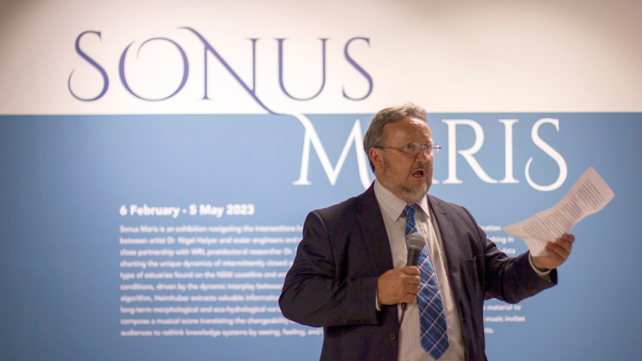
Sonus Maris was opened by Professor Stephen Foster, Dean of the Faculty of Engineering, with Martin Borchert, University Librarian, acting as Master of Ceremonies. Professor Foster gave a speech exploring the varied intersections between art and science.
Event was held on Wednesday, 8 February 2023.
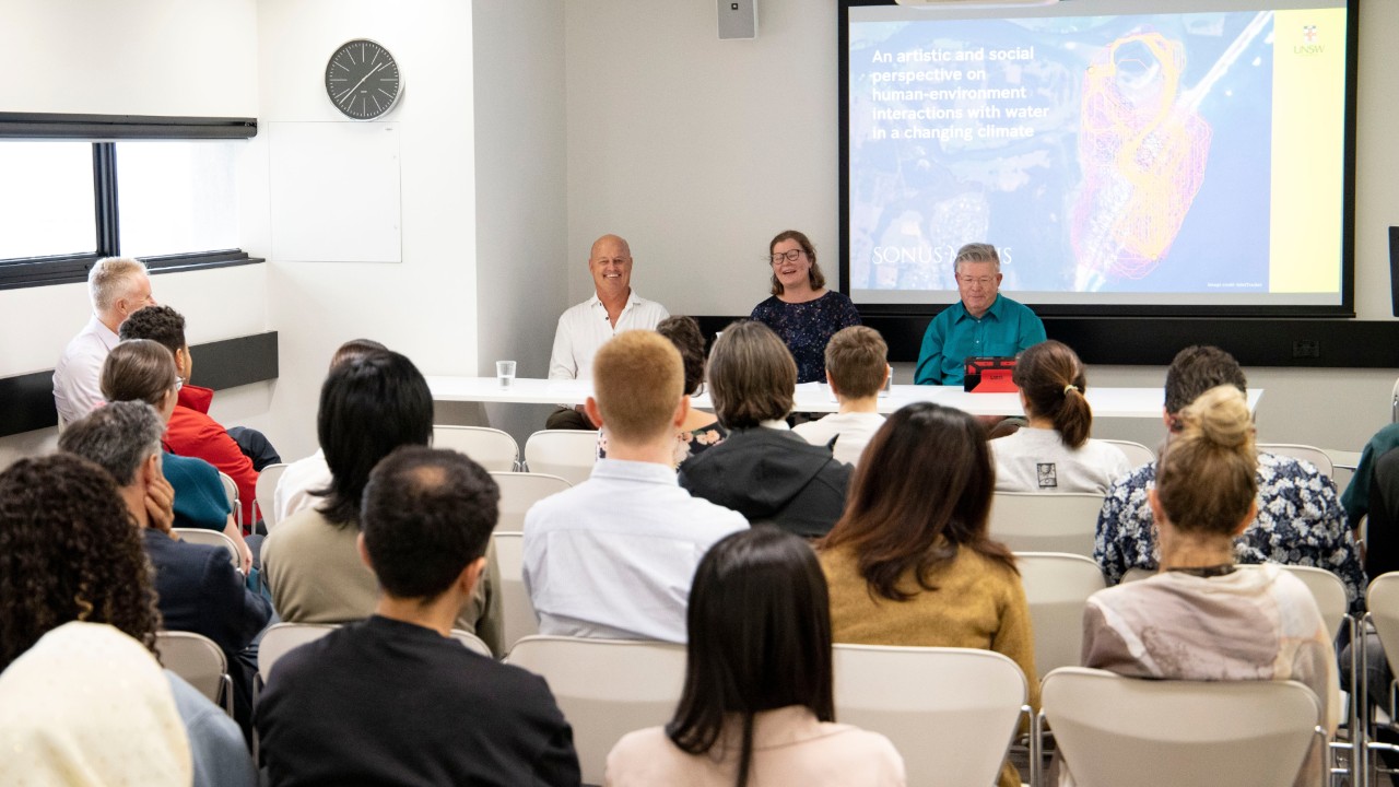
World Water Day forum
An artistic and social perspective on human-environment interactions with water in a changing climate, was a special World Water Day event co-hosted with the Global Water Institute. It featured a panel discussion among academics and researchers in water-related fields across art, science, and the humanities.
The forum was moderated by Professor Denis O'Carroll and the panellists included James Carley, Eleanor Earl, and Nigel Helyer.
Event was held on Wednesday, 22 March 2023.

New Music Collective performance
To celebrate Earth Day, the UNSW New Music Collective led by Dr Sonya Lifschitz performed a reinterpreted score of Sonus Maris at the Esme Timbery Creative Practice Lab.
The event was held on Saturday, 22 April 2023.

Touring event
Sonus Maris touring event took place at the Jervis Bay Maritime Museum, NSW.
Event was held from 5 July - 13 October 2024.